Advanced Drone Services

Sharper surveys, smarter flight ops, and modern drone training.

Adelix blends geospatial accuracy, field-ready drone services, and hands-on aerospace learning into one stronger digital presence. The refreshed UI now leads with clarity, contrast, and confidence.

50,000+ Sq km covered
2,000+ Students trained
6,000+ Flight hours delivered

Who Are We

About Adelix Drone Solutions team and operations
Precision Services
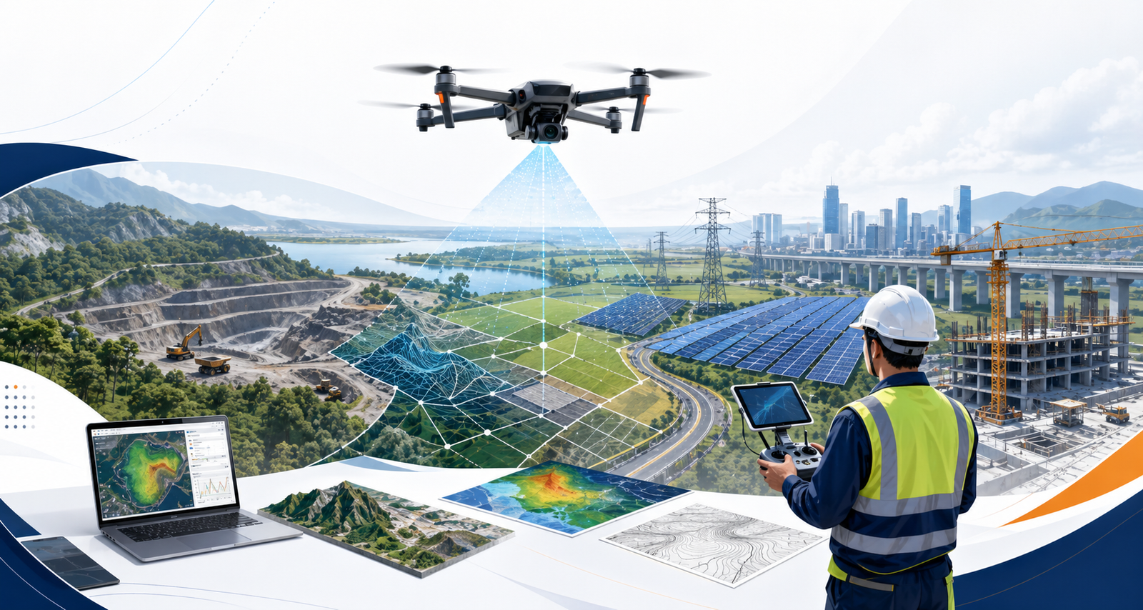
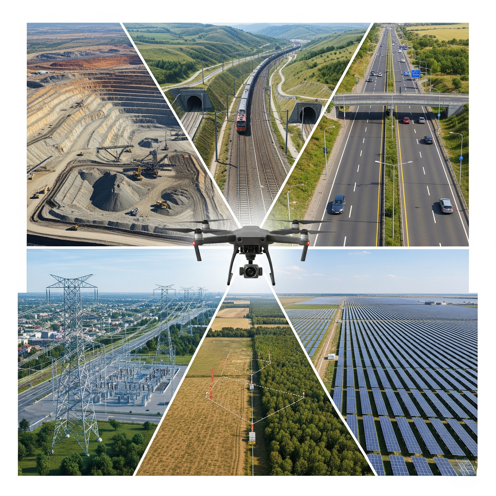
Survey & Mapping Services

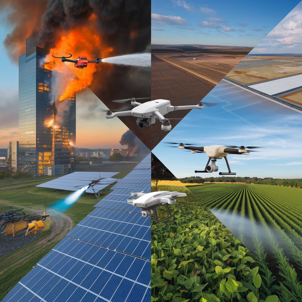
Adelix delivers professional drone survey and mapping services for organizations that need dependable aerial data. From land assessment and corridor mapping to infrastructure inspection and terrain analysis, we help clients make faster, better-informed project decisions through accurate and efficient field execution.

Smart Farming
Agriculture

In agriculture, Adelix supports modern farm operations through targeted aerial spraying and crop-focused drone solutions. Our services are designed to improve field efficiency, reduce manual effort, and support safer, more consistent coverage across large agricultural areas.
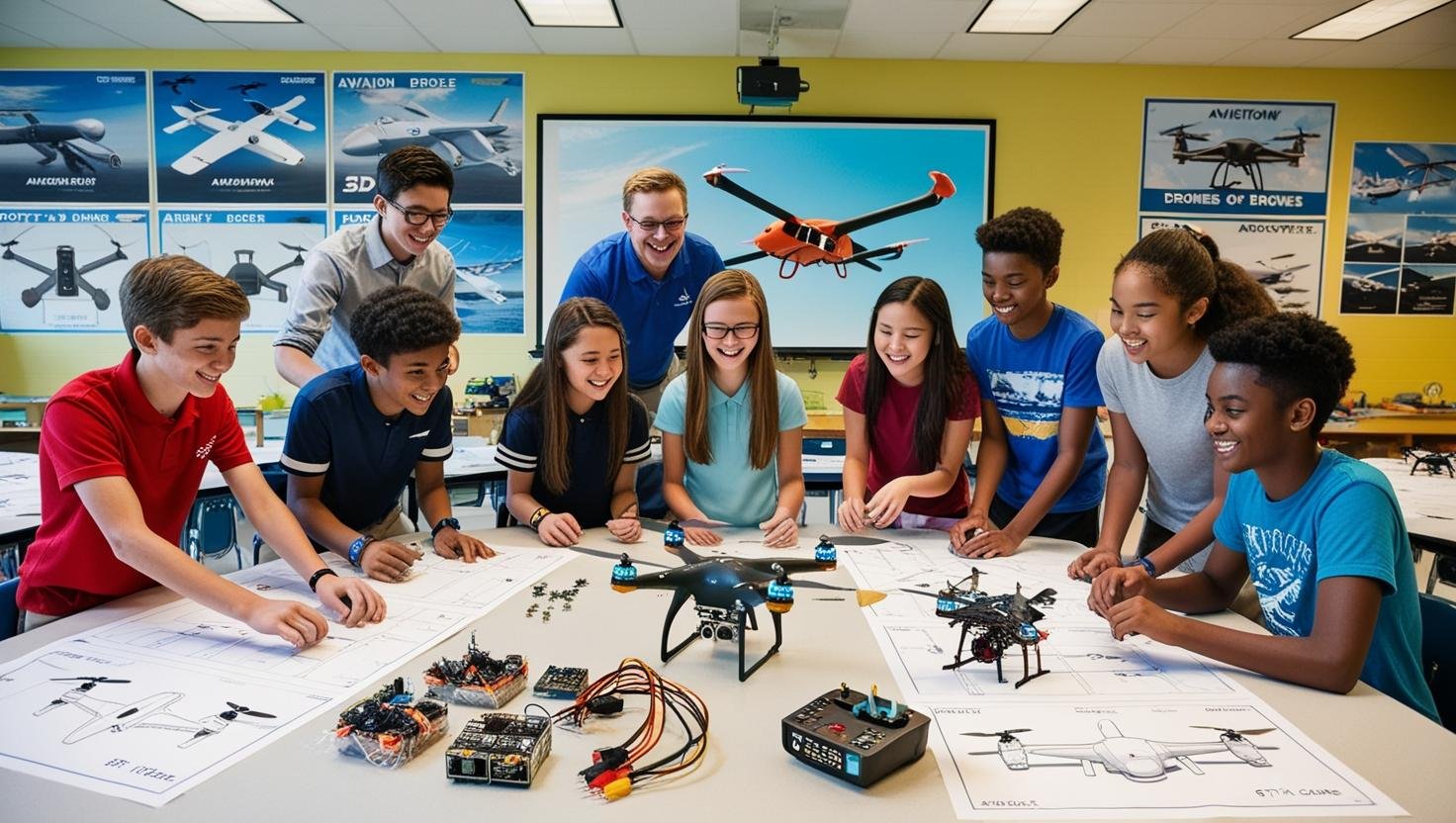
R&D and Training
Aeromodelling & Drone R&D

Beyond field services, Adelix invests in drone training, applied learning, and practical innovation. Through workshops, technical exposure, and development-focused initiatives, we help students, institutions, and partners build stronger capabilities in UAV operations, aeromodelling, and emerging aerial technologies.

Why Adelix

Adelix helps organizations collect reliable aerial data, reduce field effort, and make faster project decisions. We combine practical drone survey execution with responsive support and project-focused delivery.

Custom Adelix illustration showing drone survey expertise across infrastructure, solar, and land mapping

Accurate Survey Outputs

We focus on dependable aerial data capture for mapping, inspection, and site analysis so your team can plan and report with more confidence.

Faster Turnaround

Drone-based surveys help cover large areas efficiently, reducing field time and accelerating project progress across complex sites.

Safer Site Operations

We support work in difficult or high-risk environments by capturing critical visual data without sending teams into unsafe zones.

Industry-Focused Experience

From infrastructure and utilities to mining, solar, and land development, our services are shaped around practical project needs.

Decorative right curve

Our Services

Smart agriculture drone services visual

Smart Agriculture Drone Services

Enhance crop monitoring, seed planting, and precision spraying with modern drone-assisted field operations. Improve efficiency, reduce waste, and support better farm coverage through practical aerial technology and data-driven planning.

Decorative underline
Decorative left curve
Hands-on drone and aeromodelling workshop

Hands On Drone and Aeromodelling Workshop

For students, hobbyists, and flying enthusiasts aged 12+, this workshop introduces drone assembly, aerodynamics, and real-world flying concepts through practical hands-on learning.

It is designed to spark interest in STEM, aerospace, and robotics through an engaging first experience with drone technology.

Drone mapping & geospatial survey

Mapping & Geospatial Services

Agricultural Surveys, Land & Property Boundary Survey, Mining & Quarry Survey, Road & Infrastructure Survey, Utility Line & Pipeline Survey, Construction Site Survey, Solar Inspection Survey, Renewable Energy & Power Line Survey, Urban Planning Survey, Environment & Forest Survey, Railway Surveys, Hydro Power Plant Surveys

Decorative underline
Decorative left curve
Advanced drone and aerospace training

Advanced Drone and Aerospace Training

This advanced program focuses on drone programming, flight simulations, aerospace coding, navigation systems, and structured mission planning.

Participants build deeper technical skills through guided exposure to industry practices and more advanced aerospace applications.

Decorative underline
Remote RPTO Training

Remote RPTO Training

(Under Licensing)

Master the essentials of Remote Pilot Training (RPTO) with in-depth knowledge on drone operations, regulations, and safety protocols**.

Gain hands-on experience in flight control, aerial mapping, and autonomous drone navigation for various industries.

Decorative underline

Our Goals

Our vision is to serve industry and society through reliable drone-based solutions in surveying, mapping, agriculture, inspections, and training. We prioritize client-focused execution so that every project benefits from better efficiency, reduced field effort, and improved decision-making.

Sustainability also plays an important role in our approach. By using aerial technology to improve accuracy and reduce unnecessary manual effort, we support safer operations, responsible resource use, and long-term innovation across evolving project environments.

Our Milestones

Pioneering drone technology with innovation, expertise, and excellence.

50,000+

Sq Km Covered

6,000+

Hours of Flight

2000+

Students Trained

50+

Innovations