Agricultural Surveys

Agricultural Surveys

Aerial Mapping

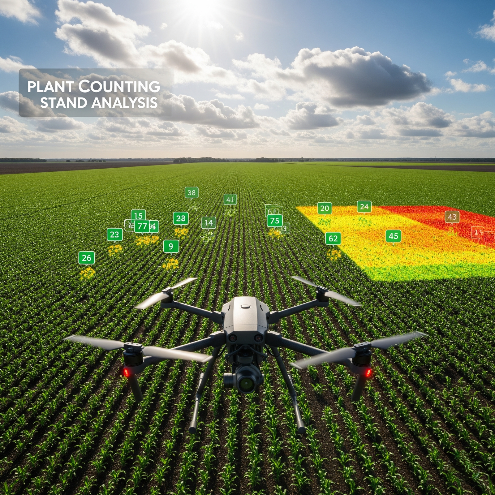
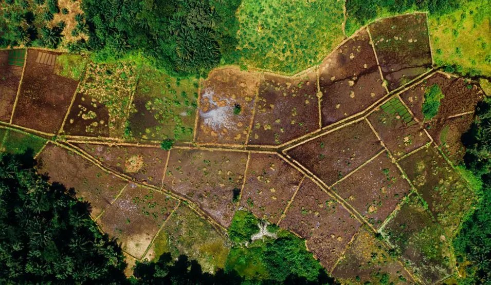
Aerial Mapping and Topographic Survey

Drones provide high-resolution aerial imagery that enables the creation of detailed orthomosaic maps and 3D terrain models. These maps can be used to generate digital surface models (DSM), digital terrain models (DTM), and elevation contours of farmlands. This data helps farmers understand the topography of their land, identify high and low areas, and plan field operations like irrigation, drainage, and planting with greater precision.

Crop Health Monitoring

Crop Health Monitoring

Using multispectral and infrared sensors, drones can monitor crop health through vegetation indices like NDVI, GNDVI, and NDRE. These surveys reveal plant stress caused by disease, nutrient deficiencies, or pest infestation. With consistent monitoring throughout the crop cycle, farmers can detect issues early, respond proactively, and ensure better crop outcomes.

Irrigation Stress

Irrigation and Water Stress Analysis

Drone surveys play a vital role in optimizing irrigation. By capturing data from thermal and multispectral sensors, drones can identify areas of a field that are either over-irrigated or suffering from water stress. They also help detect waterlogging, leaky irrigation systems, and dry zones, allowing farmers to plan water distribution efficiently and reduce wastage.

Field and Soil Analysis

Field and Soil Analysis

Before sowing, drone surveys can evaluate the condition of the soil and its suitability for planting. By mapping field texture and slope, drones help determine drainage patterns and detect erosion risks. These insights are essential for pre-planting decisions such as seed placement, tillage practices, and soil amendment needs.

Crop Growth

Crop Growth and Yield Estimation

Drones can track crop growth over time and assess different phenological stages. By analyzing plant height, canopy cover, and biomass, they provide accurate yield predictions. This enables farmers to plan harvest logistics, allocate labor and machinery, and forecast production well in advance, contributing to better resource management and profitability.

Plant Counting

Plant Counting and Stand Analysis

Drones equipped with AI and computer vision technologies can count individual plants and measure their spatial distribution across a field. This helps identify gaps in planting, assess emergence rates, and determine the overall health and uniformity of the crop stand. With this data, farmers can take corrective actions to improve stand quality and optimize yield.

Weed and Pest Detection

Weed and Pest Detection

With high-resolution imaging, drones can detect weeds and pest infestations in their early stages. These surveys pinpoint the exact locations of affected zones, allowing for precision spraying and targeted pest control interventions. This not only reduces chemical usage but also helps maintain healthy crop environments throughout the season.

>

Get in Touch With Our Hydro Power Survey Experts

Looking for advanced drone solutions for dam, reservoir, or hydro power inspections? Our experts are here to support your projects with reliable and precise data.

📧 Email Us: info@adelix.in 📧 Email Us: infoadelix@gmail.com 📧 Email Us: requirementsadelix@gmail.com 💬 Chat on WhatsApp: +91 72879 93729 📞 Call Us: +91 72879 93729