Construction Site Surveys

Accurate data acquisition and project monitoring with drone-powered construction intelligence.

Site Progress Tracking

Site Progress Tracking

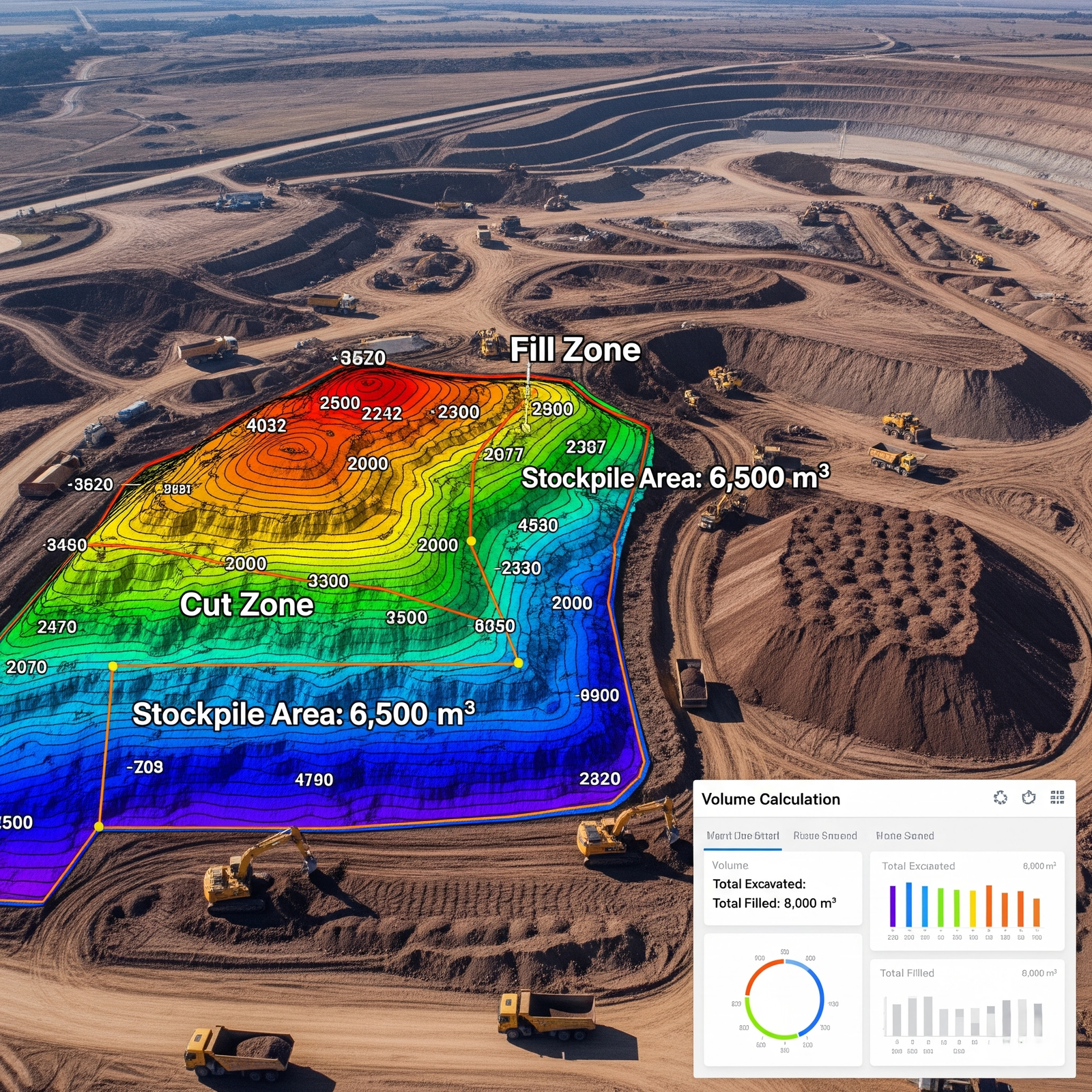
Drones enable real-time monitoring of construction site progress, providing stakeholders with aerial images, time-lapse visuals, and volumetric analysis to ensure timelines and budgets are on track.

  • Regular aerial updates
  • Progress documentation for stakeholders
  • Volume estimation for materials
  • Improved site planning and logistics
Earthwork Analysis

Earthwork and Volume Analysis

Drone surveys deliver precise elevation models and contour mapping, allowing accurate calculations of cut, fill, and material stockpile volumes. This improves efficiency and budget accuracy.

  • Digital elevation models
  • Cut & fill calculations
  • Stockpile volume measurement
  • Reduced manual surveying time
Safety Audit Survey

Safety Audits & Compliance

Safety audits can be conducted remotely with drones capturing hazard zones and non-compliant structures. Site managers get a comprehensive overview without disturbing active work zones.

  • Non-intrusive safety inspection
  • Hazard identification
  • Regulatory compliance documentation
  • Reduced safety risks for workers
As-Built Modeling

As-Built Modeling

High-resolution orthomosaics and 3D models help in comparing the actual construction with design blueprints, ensuring quality control and reducing future rework.

  • Digital twin of construction site
  • Design vs. actual verification
  • 3D modeling and point cloud generation
  • Improved documentation for stakeholders

Get in Touch With Our Hydro Power Survey Experts

Looking for advanced drone solutions for dam, reservoir, or hydro power inspections? Our experts are here to support your projects with reliable and precise data.

📧 Email Us: info@adelix.in 📧 Email Us: infoadelix@gmail.com 📧 Email Us: requirementsadelix@gmail.com 💬 Chat on WhatsApp: +91 72879 93729 📞 Call Us: +91 72879 93729