Land & Property Boundary Survey

Accurate boundary mapping using high-resolution drone imaging technology.

Land Survey

Why Choose Us?

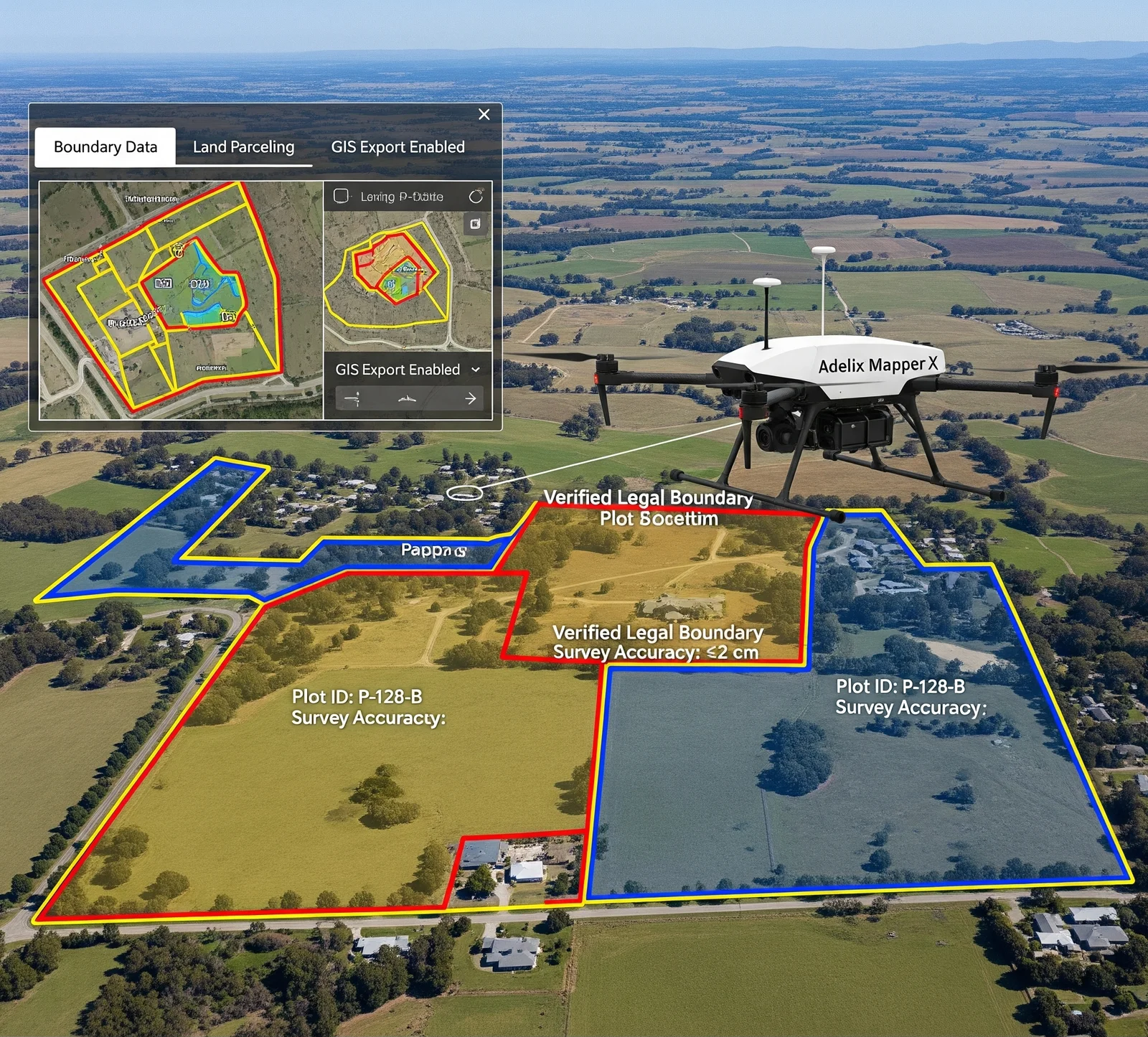
Our drone-based land and property boundary surveys offer faster, more precise alternatives to traditional methods. With centimeter-level accuracy and comprehensive aerial views, we ensure that your land is measured and documented with utmost precision.

  • Legal boundary verification
  • Real estate development and transactions
  • Land parceling and planning
  • Integration with GIS systems

Get in Touch With Our Hydro Power Survey Experts

Looking for advanced drone solutions for dam, reservoir, or hydro power inspections? Our experts are here to support your projects with reliable and precise data.

📧 Email Us: info@adelix.in 📧 Email Us: infoadelix@gmail.com 📧 Email Us: requirementsadelix@gmail.com 💬 Chat on WhatsApp: +91 72879 93729 📞 Call Us: +91 72879 93729