Railway Surveys

Railway Surveys

Track Inspection

Track and Corridor Inspection

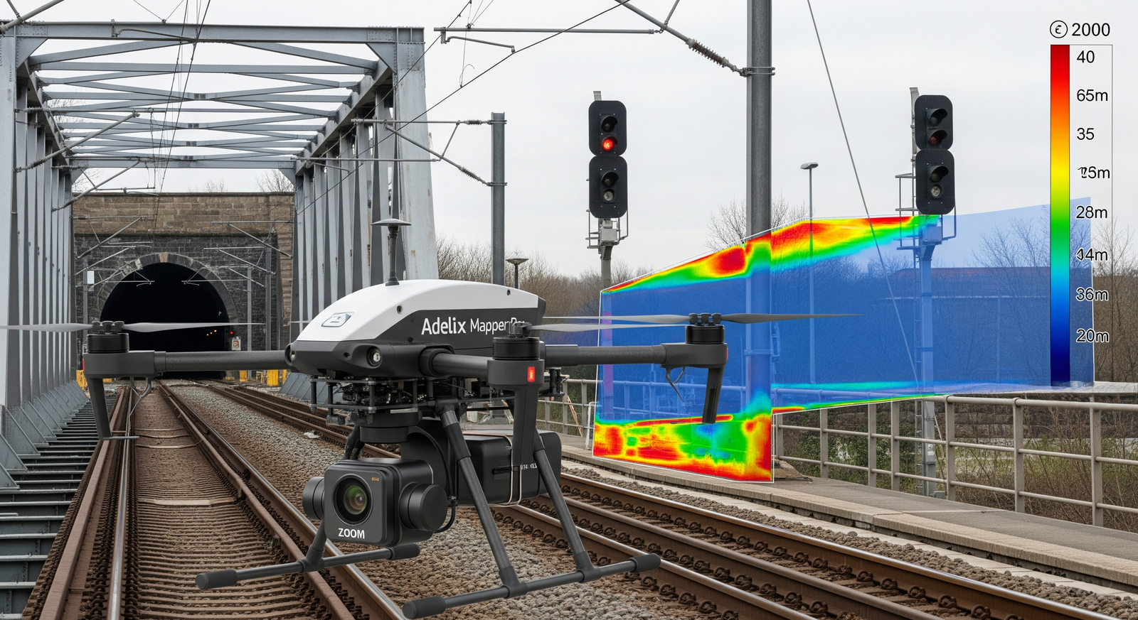
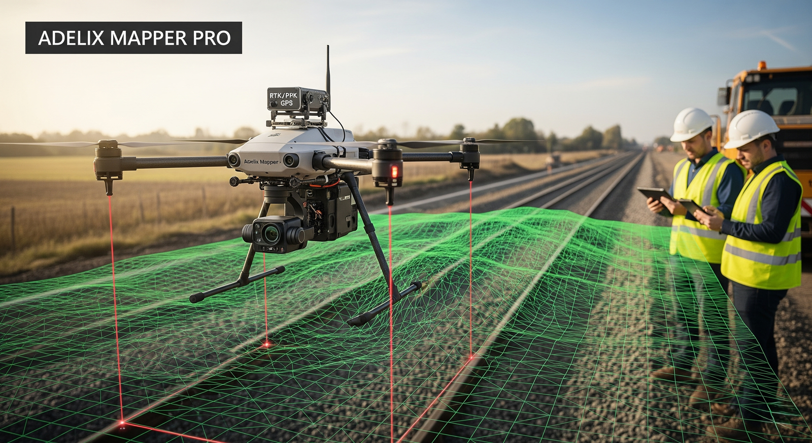
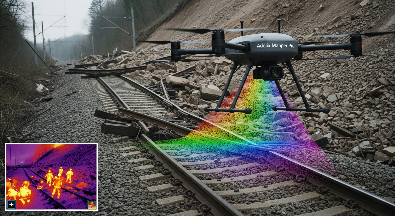
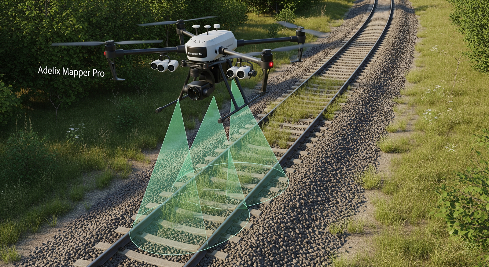
Drones equipped with high-resolution RGB cameras and LiDAR sensors are increasingly used for inspecting railway tracks and surrounding corridors. These surveys capture detailed imagery of rails, sleepers, ballast, and embankments, enabling the detection of cracks, misalignments, vegetation encroachment, and track wear. LiDAR-based mapping provides precise elevation data that helps in identifying uneven settlements, drainage issues, and slope stability along the track. The deliverables from such surveys include orthophotos, 3D rail corridor models, and defect maps that assist engineers in planning maintenance and ensuring safe train operations.

Railway Infrastructure Survey

Railway Infrastructure Survey

Beyond the tracks, drones can inspect key infrastructure such as bridges, tunnels, overhead lines, and signaling equipment. High-zoom cameras and thermal imaging allow engineers to assess the structural integrity of bridges, detect cracks, and evaluate expansion joints, while thermal sensors highlight overheating in electrical systems. For tunnels and confined spaces, drones with obstacle-avoidance systems provide access to areas difficult or unsafe for manual inspections. The outputs typically include structural condition reports, thermal anomaly maps, and visual inspection datasets that support preventive maintenance.

Railway Alignment and Mapping

Railway Alignment and Mapping

For new railway projects or expansion works, drones with RTK/PPK GPS and LiDAR technology deliver centimeter-level accuracy in mapping terrain and designing alignments. Photogrammetry combined with LiDAR generates high-resolution topographic maps and digital terrain models, which are vital for planning track geometry, cuttings, and embankments. These surveys help in reducing ground survey time while providing detailed elevation data. The deliverables include 3D topographic models, digital twins of the railway corridor, and alignment planning datasets for design engineers.

Disaster Response and Safety Monitoring

Disaster Response and Safety Monitoring

After events such as floods, landslides, or accidents, drones provide rapid assessment of damage along the railway corridor. Equipped with thermal sensors, RGB cameras, and real-time video transmission, drones deliver immediate situational awareness to railway authorities. LiDAR-based mapping helps in assessing terrain shifts or track obstructions with centimeter accuracy, while thermal imaging can assist in locating survivors in accident zones. The technical deliverables include post-disaster maps, real-time monitoring dashboards, and terrain change analysis, enabling faster restoration of services and improved safety management.

Get in Touch With Our Hydro Power Survey Experts

Looking for advanced drone solutions for dam, reservoir, or hydro power inspections? Our experts are here to support your projects with reliable and precise data.

📧 Email Us: info@adelix.in 📧 Email Us: infoadelix@gmail.com 📧 Email Us: requirementsadelix@gmail.com 💬 Chat on WhatsApp: +91 72879 93729 📞 Call Us: +91 72879 93729