Road & Infrastructure Surveys

Road & Infrastructure Surveys

Topographic Survey

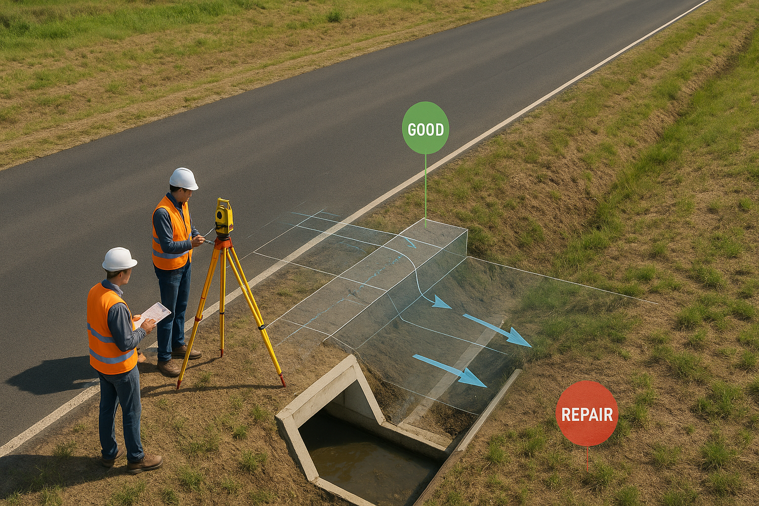
Topographic & Route Surveys

High-resolution aerial mapping captures accurate elevation and terrain details, enabling precise road alignment planning. These surveys provide contour maps, slope analysis, and terrain models essential for feasibility studies and optimal route selection.

Design Validation

Design Validation

Before construction begins, drone surveys verify engineering designs against real-world terrain data. This ensures design accuracy, minimizes costly changes, and enhances project efficiency.

Progress Monitoring

Progress Monitoring

Regular drone flights provide up-to-date visuals and 3D models of ongoing projects. Project managers can track milestones, identify delays, and maintain accurate documentation for stakeholders.

Bridge & Overpass Inspection

Bridge & Overpass Inspections

Close-up aerial inspections detect cracks, corrosion, and structural wear in bridges and overpasses without disrupting traffic. Thermal imaging helps identify hidden damage and weak points.

Pavement Condition Analysis

Pavement Condition Analysis

Low-altitude drone imagery reveals surface defects such as potholes, rutting, and cracks. Early detection helps schedule timely repairs and extend pavement lifespan.

Drainage & Culvert Surveys

Drainage & Culvert Surveys

Specialized surveys assess the placement, slope, and condition of roadside drainage systems and culverts. This ensures effective water flow, prevents flooding, and maintains road safety.

Traffic & Safety Studies

Traffic & Safety Studies

Drone-based traffic monitoring analyzes vehicle flow, congestion points, and pedestrian safety. This data helps improve road designs and reduce accident risks.

Encroachment & ROW Monitoring

Encroachment & ROW Monitoring

High-resolution aerial imagery detects unauthorized constructions or land use within the road's right-of-way (ROW). Quick detection enables timely enforcement and protection of infrastructure assets.

Get in Touch With Our Hydro Power Survey Experts

Looking for advanced drone solutions for dam, reservoir, or hydro power inspections? Our experts are here to support your projects with reliable and precise data.

📧 Email Us: info@adelix.in 📧 Email Us: infoadelix@gmail.com 📧 Email Us: requirementsadelix@gmail.com 💬 Chat on WhatsApp: +91 72879 93729 📞 Call Us: +91 72879 93729