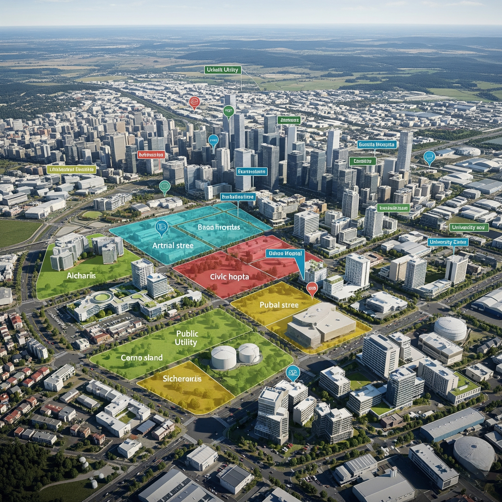
City Layout & Infrastructure Planning
Support master planning through high-resolution topographic data and 3D city models.
- Urban land use analysis
- Building & road layout mapping
- Smart city GIS data capture
- Public utility space identification
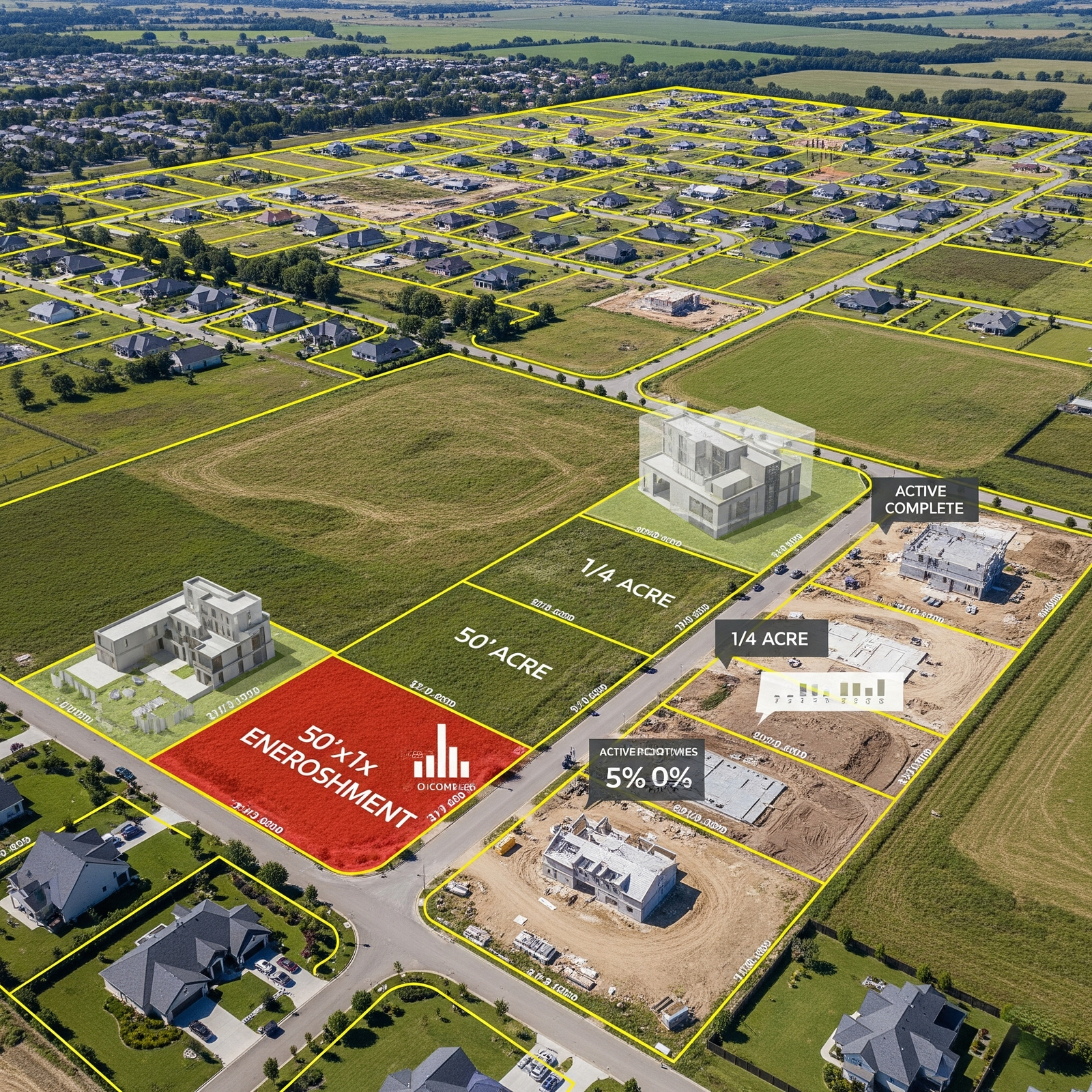
Real Estate & Property Mapping
Provide accurate plot boundaries, land development visualizations, and asset documentation.
- Property encroachment detection
- 3D modeling for project promotion
- Land subdivision support
- Real-time construction monitoring
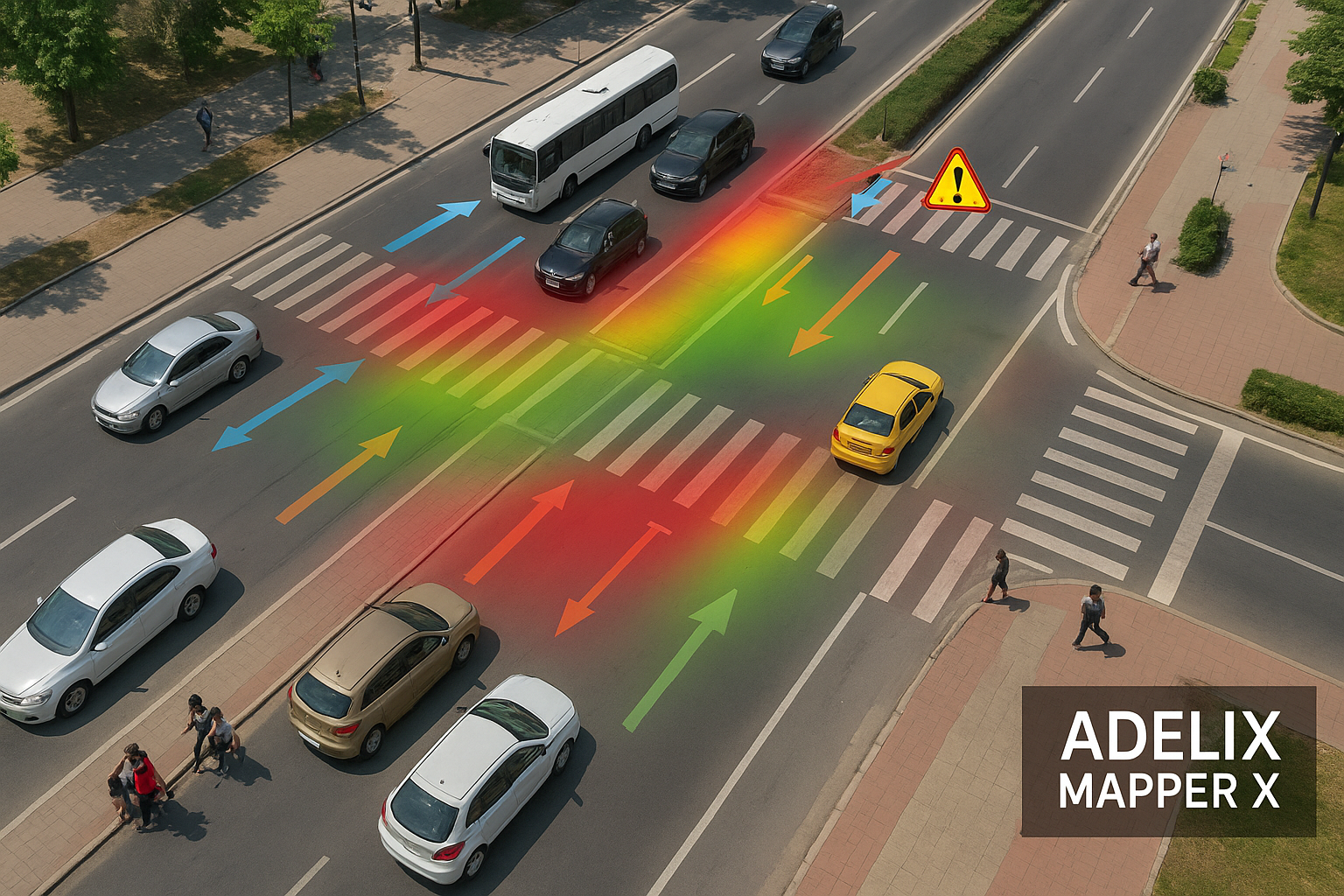
Traffic Flow & Road Network Analysis
Monitor urban traffic patterns and improve infrastructure efficiency with aerial surveys.
- Traffic congestion mapping
- Road condition assessment
- Junction and lane planning
- Data for smart transport systems
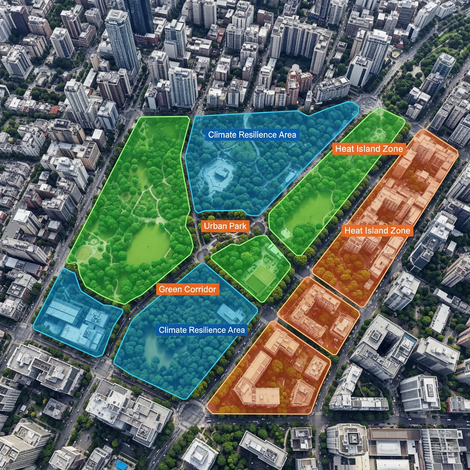
Green Space & Environmental Zoning
Plan parks, urban forests, and green corridors using multispectral imagery and GIS data.
- Vegetation index & health reports
- Climate resilience zoning
- Heat island detection
- Sustainable urban development input
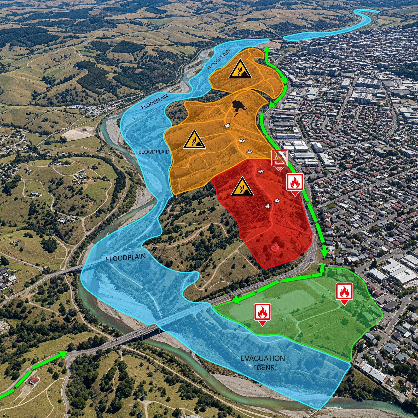
Disaster Risk & Resilience Planning
Mitigate risks from urban floods, landslides, and fire-prone zones using predictive drone mapping.
- Floodplain mapping & runoff flow
- Landslide-prone zone identification
- Emergency access route planning
- Evacuation strategy support maps